
Maptino Facilities Management Assessments
A web portal that maps a council’s or utility’s vertical assets, grades every one of them by location value, and runs the whole carrier access process — request, queue, approval clock, licence — in one place.
Overview
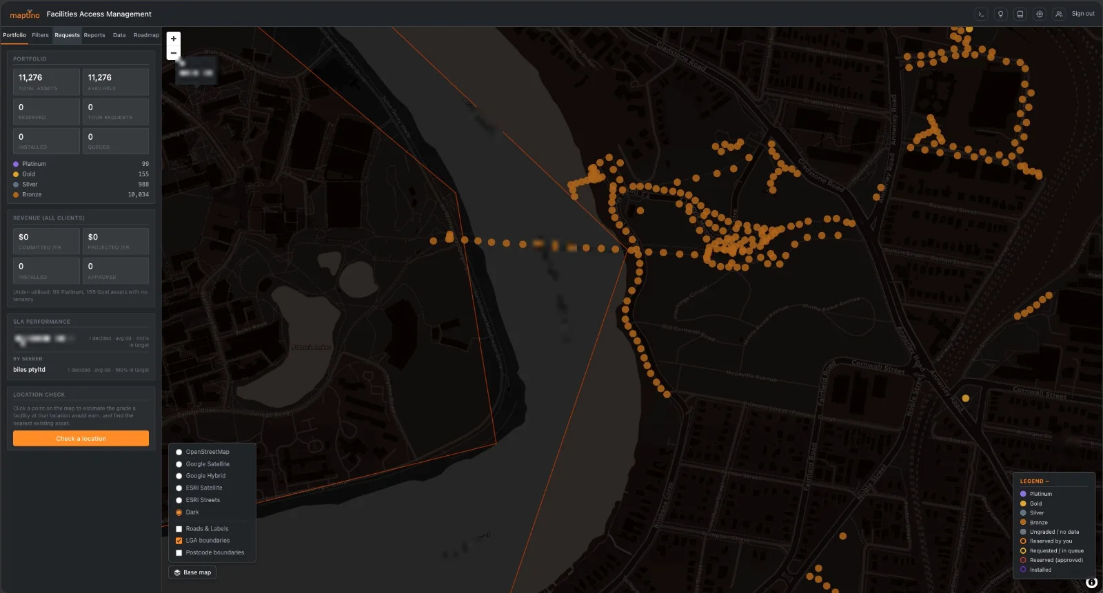
Maptino FAM is a facilities access management portal for the organisations that own vertical assets — councils with streetlight and smart poles, utilities with distribution poles — and the carriers who want to attach equipment to them. Load the asset register and FAM maps it, grades every asset by commercial location value, and publishes what a carrier needs to self-qualify: availability, power and backhaul states, and the structural envelope of what can actually be hung on the pole. Carriers request assets, queue fairly when one is contested, and submit equipment details and drawings that are screened automatically against that envelope.
Behind it sits the part that matters to the asset owner: a decision clock that respects statutory timeframes, stops when more information is requested, and applies deemed outcomes when a deadline passes — on the owner’s own versioned standard conditions. Every step is auditable, and the whole allocation record can be exported for a dispute.
Capabilities
- Asset map. Every asset graded and colour-coded, with LGA and postcode boundaries, imagery and street basemaps.
- Location-value grading. A composite grade per asset from the owner’s reference layers; customers see the grade, never the method.
- Reservations and queues. Request an asset, see your position, watch the countdown; first-in-time queueing with the owner’s own holds included.
- Decision clock. Per-client targets, clock-stop on incomplete applications, early warnings, and deemed approval or rejection by posture.
- Standard conditions. Versioned templates; every approval records the exact version in force.
- Attachment envelope. Weight, wind area, height, spare cable entries, utilisation, heritage and LV-mains flags, with automatic screening of every request and bulk structural approval by pole class.
- Publication states. Red/Amber/Green for power, backhaul and availability, each with provenance and a verified date.
- Commercial layer. Rate cards, indicative pricing, an owner revenue dashboard and a database of public rent comparables.
- Reporting. Branded PDF, CSV, XLSX and KML, plus duplicate-asset detection and expiring public listing links per asset.
- Public deployment tracker. An opt-in, aggregate-only progress page a council can share.
- Built-in help. Role-aware guide plus hover hints that can be switched off.
Under the hood
The redaction boundary is enforced server-side, not in the interface — a customer’s map, reports, exports and public listings carry grade labels and availability only, never scores, criteria or another carrier’s identity, and a built-in audit runs that as a live self-test. Multi-tenant by dataset: an account bound to one estate simply cannot see the others. Grading was validated against a real delivered dataset — 11,276 assets re-scored in-app with zero mismatches. Takes the data as it comes: CSV, XLSX, GeoJSON, KML or KMZ, with duplicate rejection and coordinate quality checks on upload, plus an audit tool and automatic nightly backups operable from inside the portal.
Built by Kevin Biles Consulting Pty Ltd trading as Maptino. Uses OpenStreetMap data (© OpenStreetMap contributors, ODbL) for basemaps and points of interest, and Australian Bureau of Statistics ASGS 2021 boundaries (CC BY 4.0) for LGA, postcode and statistical area imports. Full third-party attributions are listed in the portal’s licence panel.
Want a demo, a licence, or a survey done?
One email covers all of it — tell us the tool or the job, and the region.