
RFMapper Drive Planner — Tablet Edition
An Android tablet app for planning and running RF drive tests and Wi-Fi surveys — route planning from OpenStreetMap, live coverage tracking, indoor and outdoor survey.
Overview
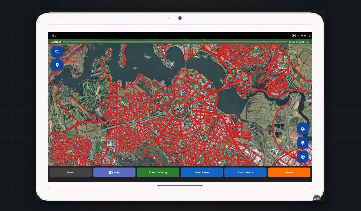
One app for planning a drive test, driving it, and surveying the buildings at either end. Pick an area and it pulls the roads from OpenStreetMap, then paints your progress against that plan as you drive — so “how much of this suburb have we covered” has an answer rather than an estimate. Alongside it: GPS trails with autosave, field notes, floor-plan annotation for indoor work, Wi-Fi signal survey, and an Android Auto screen showing coverage on the car display.
The part worth dwelling on is what it does with roads nobody has described properly. OpenStreetMap carries surface and access tags on only a fraction of its network, so the planner treats “sealed”, “unsealed” and “not recorded” as three separate answers you can include or exclude. Most tools quietly assume the third is the first. The same rule runs through the exports: an unmeasured value is an empty cell, never a plausible zero.
Capabilities
- Drive plan generation. Pick an area, pull its roads from OpenStreetMap, filter by road class, surface and access.
- Live coverage tracking. Roads change colour as you drive them; percentage, distance and remaining segments as you go.
- GPS trail recording. Autosaved as you drive, exported to KML and CSV.
- GPS status panel. Satellites used against satellites seen, fix quality, constellations contributing, and how long since the last fix.
- Wi-Fi survey. Indoor and outdoor signal measurement with nearby access-point scans, and an optional speed test per captured point.
- Floor plan annotation. Photograph a plan, drop numbered test points on it, export the annotated image.
- Points of interest. Import KML or KMZ layers of towers, sites or anything else worth seeing on the map, kept in a project between sessions.
- Field notes. Categorised, pinned to a position, exported with the session.
- Android Auto. Coverage progress on the car display while driving.
- Upload. SFTP to a landing zone — off by default and opt-in.
Under the hood
Nothing leaves the device unless you switch it on — upload is opt-in and defaults to off, with no server credentials compiled into the app; they are entered on the device and stored encrypted. Blank cells in an export are deliberate: where the platform reported no altitude, speed, bearing or signal, the column is empty — a zero would read as sea level, stationary, due north, or a measured reading. And the map works before the GPS does: it opens where you last left it, so a survey planned yesterday is still on screen today. Built for tablets on Android 10 and later, targeting Android 16, sideloaded — no app store listing.
Built on OpenStreetMap data via the Overpass API (© OpenStreetMap contributors, ODbL). Maps rendered with osmdroid. Part of the RFMapper product family, by Maptino.
Maptino Drive Test
Professional-grade RF capture from an unrooted Android — 5G NR, LTE, roaming and satellite NTN, logged and uploaded automatically.
RFMapper Desktop Analysis
Import survey logs, split by carrier, map coverage, find drop-out zones and generate the client report.
RFMapper ACMA Spectrum Mapping
ACMA apparatus and area-wide licences, availability and expiry on one interactive HCIS map.
Want a demo, a licence, or a survey done?
One email covers all of it — tell us the tool or the job, and the region.