Tools — Maptino
Maptino
Tool catalogue

Six tools, one workflow.

Plan on the desktop, capture in the field, analyse and report back at the desk. RFMapper tools carry their own branding, shown as shipped.

DRIVE TEST DESKTOP ANALYSIS DRIVE PLANNER ACMA SPECTRUM CONNECTIVITY FACILITIES
FIELD · ANDROIDRFMAPPER

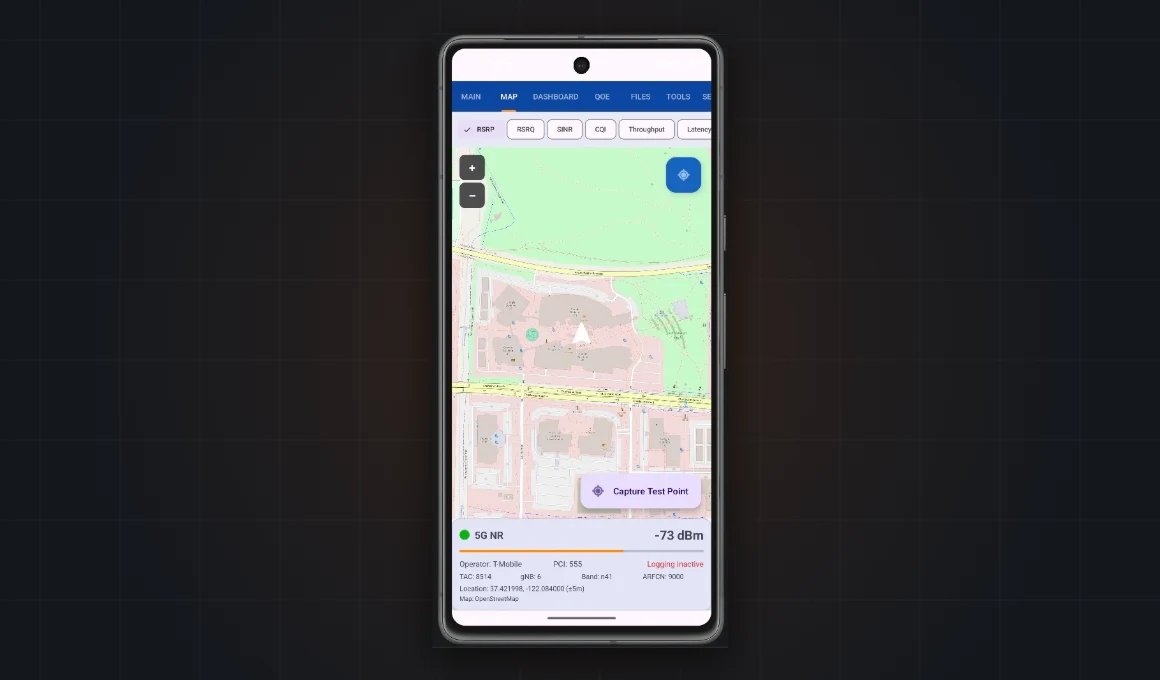
Maptino Drive Test

Professional-grade RF measurement from an unrooted Android device. Collects 4G LTE and 5G NR radio parameters while driving, walking or surveying indoors — every metric the radio exposes, logged to a unified CSV and fed straight into an automated processing pipeline.

  • 5G NR, LTE, UMTS and GSM captured simultaneously — no root required
  • Roaming and LEO satellite (NTN) detection logged per sample
  • QoE test suite, indoor floor-plan heatmaps, scripted automation
  • SFTP upload into automated map + evidence-report generation
Enquire More detail ANDROID 10+ · NO ROOT REQUIRED
Maptino Drive Test on a phone
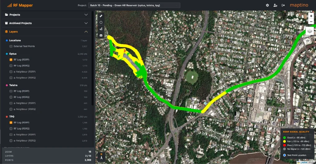
Maptino Desktop Analysis
DESKTOPRFMAPPER

RFMapper Desktop Analysis

The desk end of the loop. Import drive-test logs, visualise coverage, compare networks side by side and turn a day of driving into a report.

  • Coverage visualisation and comparison
  • Works directly with Drive Test captures
  • Report and map exports
Enquire More detail AVAILABLE BY ENQUIRY
FIELD · TABLETRFMAPPER

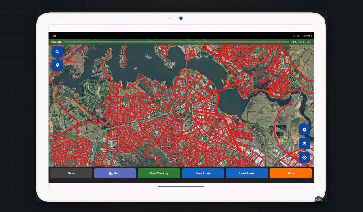
RFMapper Drive Planner — Tablet Edition

Plan the survey before you roll. Build drive routes, mark target sites and carry the plan on the tablet beside you.

  • Route building and site targeting
  • Tablet-first, in-vehicle friendly UI
  • Plans feed the Drive Test workflow
Enquire More detail AVAILABLE BY ENQUIRY
RFMapper Drive Planner on a tablet
COMING SOON
DESKTOPRFMAPPERAU

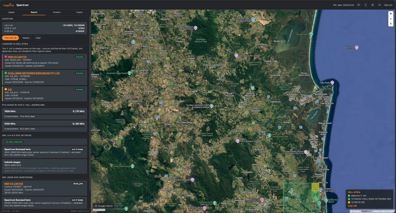
RFMapper ACMA Spectrum Mapping

ACMA licence data, on a map instead of a register. See who holds what spectrum, where — for planning, interference work and acquisition due diligence.

  • ACMA licence records mapped spatially
  • Filter by band, licensee and area
  • Australia-specific data source
Enquire More detail AVAILABLE BY ENQUIRY
DESKTOPMAPTINO

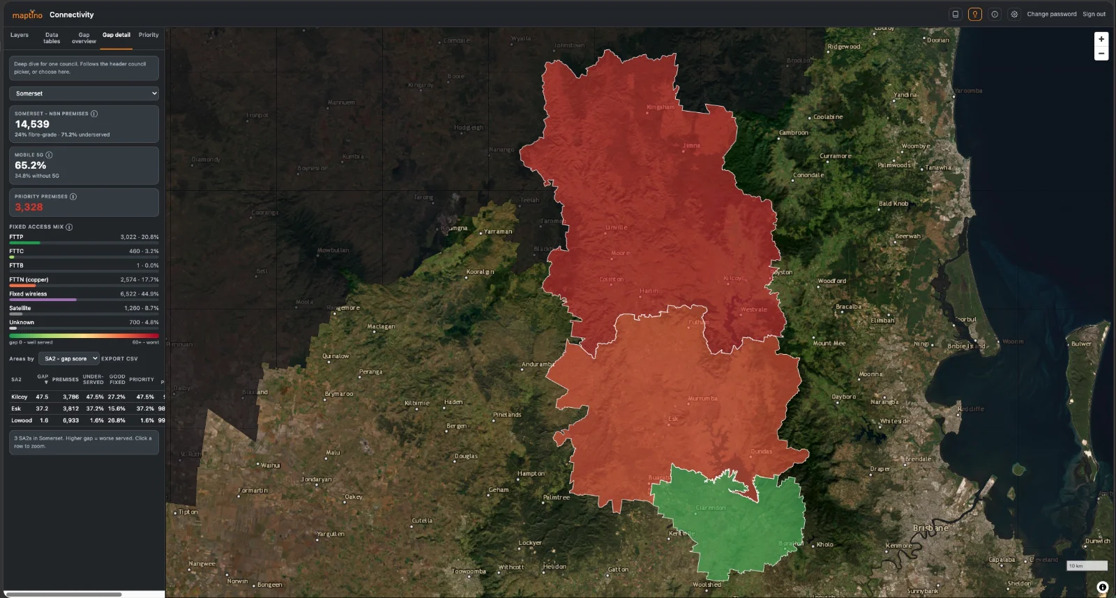
Maptino Connectivity

See exactly where connectivity fails, and who it fails. Turns raw broadband and mobile data into a map you can act on — every property with no good fixed connection, no mobile coverage worth relying on, and nothing scheduled to change that, ranked so the worst-served areas surface first.

  • Premises-level detail — the actual properties, not a shaded polygon
  • Consistent 0–100 scoring, ranked automatically across areas
  • Tunable prioritisation — weight severity, scale and coverage; re-ranks live
  • Self-hosted: a single container in your own environment — no data leaves it
  • Exports — CSV tables, PNG/PDF views with legends, submission-ready
Enquire More detail DEPLOYED: 1.6M PREMISES · 11 LGAs
Maptino Connectivity map view
COMING SOON
FIELDMAPTINO

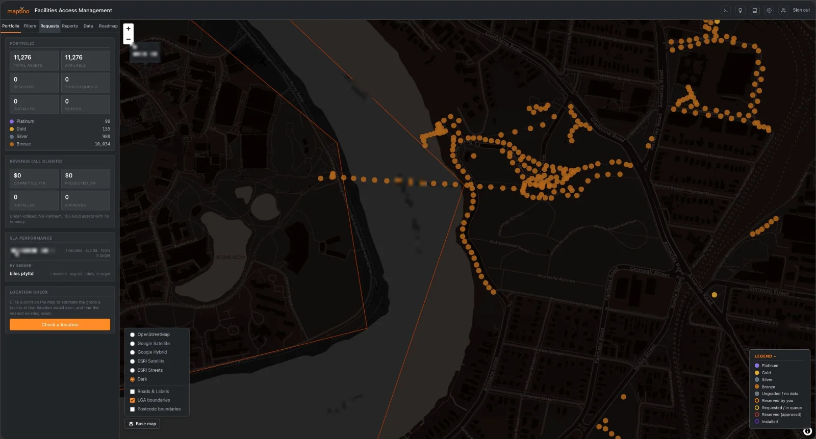
Maptino Facilities Management Assessments

Structured on-site connectivity assessments for facilities — walk the site, capture consistently, score it and hand over a report the client can act on.

  • Structured capture — same assessment every site
  • Scoring against connectivity requirements
  • Client-ready reporting
Enquire More detail AVAILABLE BY ENQUIRY
Tool detail

Maptino Drive Test

Android RF measurement and network testing app for telecom field engineers.

Overview

Commercial drive-test tools are expensive, often need rooted devices or proprietary hardware, and lock data inside vendor ecosystems. Maptino Drive Test delivers professional-grade measurement on any standard Android phone — RSRP, RSRQ, SINR, PCI, EARFCN/ARFCN, carrier aggregation, gNB/eNB IDs — with GPS fused to every sample and a unified 66-column CSV per log.

Per-sample registration state (home / roaming / emergency-only) and LEO satellite detection mean foreign-network and satellite measurements are flagged rather than polluting coverage maps and KPI results.

Capabilities
  • Multi-technology capture. 5G NR, LTE, UMTS and GSM collected simultaneously from a single unrooted device.
  • Roaming & NTN tracking. Registration state per sample, plus LEO satellite detection (Android 15 API with heuristics for older devices).
  • QoE testing suite. Eight engines — speed, ping, DNS, traceroute, iPerf3, TWAMP, video streaming, web load — correlated with RF conditions.
  • Indoor mapping. Floor-plan waypoint surveys with signal heatmaps, DAS markup and an AR positioning framework.
  • Reporting. PDF/HTML reports with configurable KPI pass/fail thresholds, ready as client deliverables.
  • Test automation. 10-command scripting DSL, workflow engine and work-order integration for scheduled campaigns.
  • AI analytics. Five anomaly-detection algorithms plus coverage prediction for unmeasured areas.
  • Multi-device control. Synchronised campaigns across additional tablets via Bluetooth or WiFi from one controller view.
  • Upload pipeline. Queued SFTP/FTP with retry into the RFMapper server pipeline — automated map visualisations and DOCX evidence reports.
Deployment

Standard APK on Android 10+ — no root, no special hardware, no per-device licensing. Dual map providers (OpenStreetMap / Google Maps) with live signal-coloured route overlay. Part of the Maptino RFMapper suite.

Tool detail

RFMapper Desktop Analysis

Full write-up coming soon.

Overview

What RFMapper Desktop Analysis does, the problem it solves, and how it fits the workflow. (Detail to come.)

Capabilities

Key features and data sources. (Detail to come.)

Availability

Licensing and how to get it. (Detail to come.)

Tool detail

RFMapper Drive Planner — Tablet Edition

Full write-up coming soon.

Overview

What Drive Planner does, the problem it solves, and how it fits the workflow. (Detail to come.)

Capabilities

Key features and data sources. (Detail to come.)

Availability

Licensing and how to get it. (Detail to come.)

Tool detail

RFMapper ACMA Spectrum Mapping

Full write-up coming soon.

Overview

What ACMA Spectrum Mapping does, the problem it solves, and how it fits the workflow. (Detail to come.)

Capabilities

Key features and data sources. (Detail to come.)

Availability

Licensing and how to get it. (Detail to come.)

Tool detail

Maptino Connectivity

See exactly where connectivity fails, and who it fails.

Overview

Most connectivity reporting stops at a percentage. A council is told it has 94% coverage and is left with no idea which streets make up the other 6%, or whether those premises are about to be upgraded anyway. Maptino Connectivity answers the question underneath: it combines fixed-line technology records, mobile coverage as reported by the carriers, and published upgrade plans, and resolves them down to individual premises.

The result is a map where you can select any neighbourhood and see the affected properties themselves — not a shaded polygon, the actual points. A percentage invites argument. A map of 1,800 specific premises with no fibre, no 5G and no upgrade scheduled does not.

Capabilities
  • Premises-level detail. Select a statistical area and the affected properties appear on the map, with a count that matches the reported figure.
  • Consistent scoring. Every area scored 0–100 on the same basis, so areas of different sizes compare honestly.
  • Ranked automatically. The worst-served areas surface without manual analysis.
  • Tunable prioritisation. Weight severity, scale and coverage to match your funding criteria; the shortlist re-ranks in real time.
  • Layered context. Infrastructure, community facilities, land use, planning overlays and hazard data alongside the connectivity picture.
  • Exports. Any table to CSV, any view to PNG or PDF with a legend.
  • Built-in explanations. Every measure carries a plain-English note on how it is derived and what it does not tell you.
  • Runs anywhere. A single container on your own cloud or on-premises server. No data leaves your environment.
  • Works on restricted networks. If background map imagery is blocked by a firewall, the platform says so and keeps working — every data layer continues to function. Air-gap compatible.
Proof of scale

Currently deployed across a region of 1.6 million premises and 11 local government areas, resolving to individual properties, running as a single self-hosted container.

Who it is for

Local and regional government (grant submissions, defensible prioritisation) · state agencies and regional development bodies (consistent cross-LGA comparison) · network operators and infrastructure builders (genuinely unmet demand) · consultancies (a delivered evidence base) · utilities and asset owners (assets relative to gaps).

Tool detail

Maptino Facilities Management Assessments

Full write-up coming soon.

Overview

What Facilities Assessments does, the problem it solves, and how it fits the workflow. (Detail to come.)

Capabilities

Key features and data sources. (Detail to come.)

Availability

Licensing and how to get it. (Detail to come.)

Maptino
CONNECTIVITY & RADIO SURVEY TOOLS · AU / UK / WORLDWIDE